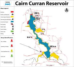
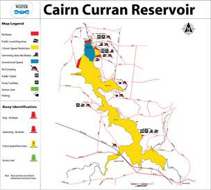
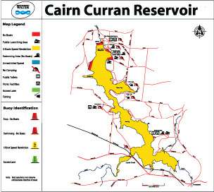
Cairn Curran is a popular spot for power boating, personal water craft, sailing, rowing and canoeing. The Cairn Curran Sailing Club holds regular events between October and April.
Vessels can be launched from public boat ramps around the reservoir (see map).
A 5 knot speed limit applies at any level within 50 metres of the water's edge; other vessels, navigation aids, swimmers and fixed or floating structures; and within 100 metres of vessels displaying a dive flag.
Keep a lookout at all times for hazards and other vessels.
Refer to the Victorian Recreational Boating Safety Handbook at the transport Victoria website.
Operating levels
The operating levels are as follows:
Click on a map to open a larger version
Operating level 1
When the storage level is above 200.00mAHD (28% capacity) normal boat zoning rules apply.

Operating level 2
When the storage level is between 199.99 mAHD (28% capacity) and 196.00mAHD (13% capacity) the following rules will apply:
- All operators must observe all the buoyed boating zones
- Operation of all vessels at a speed above five knots is restricted to the open waters known as Tower Bay.

Operating level 3
When the storage level falls below 196.00mAHD (13% capacity) the reservoir will be closed to all vessels operating at a speed in excess of five knots.

Boat ramp operating levels
This table shows at what level boat ramps at Cairn Curran can be used. The percentage indicates the lowest the storage can get before the ramp becomes unusable.
| Boat ramp |
Operational when storage is above |
| Woolshed Bay North |
26.7% |
| Woolshed Bay South |
33.3% |
| Tower Bay |
2% |
| Picnic Point |
20.9% |
| Weslhmans Reef |
48.3% |